Search
Sugar Plantations Map of Barbados by Thomas Jefferys 1750. Shows the surnames of the owners of the major sugar plantations across Barbados in 1750.
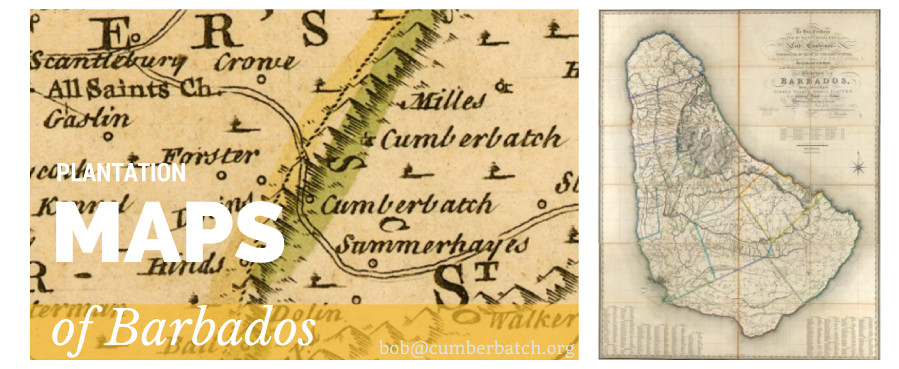
Barbados Map by Thomas Jefferys 1750
A Map of the Island of Barbados Drawn from an Actual Survey, and from the Observations of the Revd. Mr. Griffith Hughes, M.A.F.R.S. By Thomas Jefferys, Geographer. Map of Barbados showing the parish divisions and roads. Relief shown pictorially.
The key at bottom left of the map shows hat the map contains:
- Towns
- Churches
- Forts or Fortifications
- Plantations of greatest Note or Sugar Works of three Windmills
- of two Mills
- of one Mill
- Plantation sof less Note
- Rocks under Water
- Roads
From: The Natural History of Barbados by the Reverend Mr. Griffith Hughes
Map source: https://jcb.lunaimaging.com/
This map shows Barbados plantation owners and plantations. It includes the Cumberbatch owned sugar plantations at Clelands and Breedys in St Andrew but near to All Saints Church in St Peter.